File:Figure Representative of Mapped Locations.png
Jump to navigation
Jump to search
Size of this preview: 800 × 451 pixels. Other resolution: 1,216 × 685 pixels.
Original file (1,216 × 685 pixels, file size: 108 KB, MIME type: image/png)
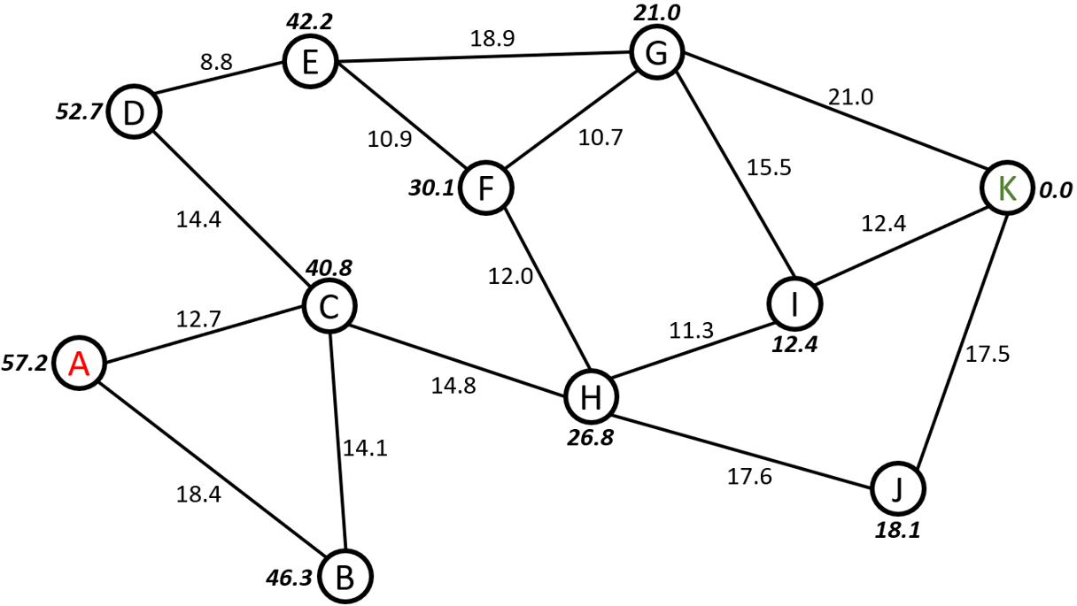
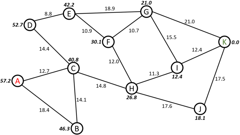
In this figure, a representation of mapped locations is shown. Each node is a location, and the lines between the nodes represent the path their respective nodes. The numbers on the paths are the distance from between each node. The numbers next to each node represents the straight-line distance between each node, and the objective node.
File history
Click on a date/time to view the file as it appeared at that time.
| Date/Time | Thumbnail | Dimensions | User | Comment | |
|---|---|---|---|---|---|
| current | 12:27, 30 November 2021 | | 1,216 × 685 (108 KB) | Aeblanco21 (talk | contribs) |
You cannot overwrite this file.
File usage
The following page uses this file: